FreshRSS

Zobrazení pro čtení

Jsou dostupné nové články, klikněte pro obnovení stránky.

Calculating Empires: an huge online chart of tech history

Calculating Empires

Calculating Empires is a "a genealogy of technology and power since 1500" — a beautiful and interactive monochrome chart you can zoom in and out of to trace the connections between all such things in the modern age. I immediately crash zoomed in and found myself face-to-face with a Debord quote: "In societies where modern conditions of production prevail, all of life presents itself as an immense accumulation of spectacles. — Read the rest

The post Calculating Empires: an huge online chart of tech history appeared first on Boing Boing.

Last Epoch balances monsters, tweaks skills, and applies general bug fixes and updates

What’s new in the OARPG that is Last Epoch? Tweaks, fixes, and adjustments that touch on a wide assortment of gameplay matters according to the title’s two most recent patches, which affect things like monsters, abilities, nemesis monsters, and more. The updates are all generally pretty targeted, as one might expect, with highlights including a […]

Apex Legends Shockwave season adds unlimited revivals, dual-wielding, and a versus bots mode August 6

The next season for Apex Legends – you know, the battle royale shooter that wanted to double-charge players for battle passes until fans furiously pushed back – is hoping that the gameplay features of its upcoming Shockwave season will be enough of a distraction from that kerfuffle, particularly as the FPS is bringing several updates […]

Google rounds off Maps redesign with a new simplified bottom bar

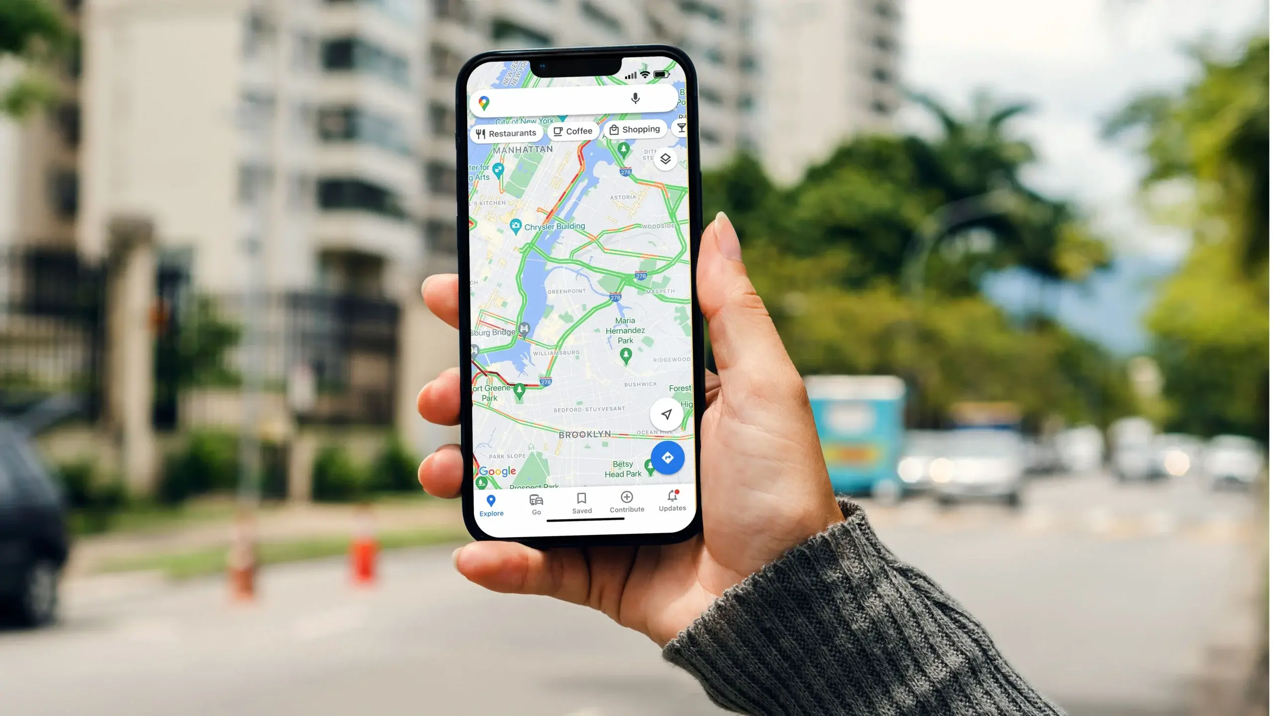
Google Maps GPS Nagivation stock photo

Credit: Edgar Cervantes / Android Authority

  • Google Maps’ simplified bottom bar redesign is finally rolling out to users.
  • The updated design features three tabs: Explore, You, and Contribute.
  • The Explore and Contribute tabs are the same as before, but the new You tab integrates features from the old Go, Saved, and Updates tabs.


Google is finally rolling out the Maps bottom bar redesign it first showcased at I/O this May. The simplified design briefly appeared for some users earlier this year, but it’s now widely available with Google Maps for Android version 11.138.x.

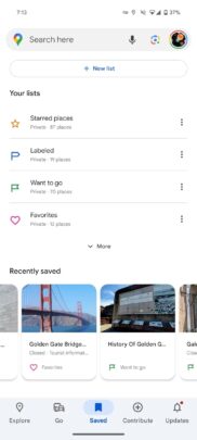
Google Maps’ bottom bar previously featured five tabs: Explore, Go, Saved, Contribute, and Updates. As you can see in the following screenshots, the redesigned bottom bar has just three tabs: Explore, You, and Contribute.

9to5Google reports that the Explore and Contribute tabs still offer the same functionality as before, but the new You tab now includes features previously offered in the Go, Saved and Updates tabs. The You tab is essentially a renamed version of the old Saved tab, and it’s largely the same in terms of the UI and features. However, it now also offers features from the Go and Updates tabs.

The Go tab’s features are now condensed into a new “Saved trips” option in the Your lists section on the You tab, and it gives you quick access to your favorite trips. Similarly, the notifications and messages options from the Updates tab have found a new place in the top right corner of the You tab.

The bottom bar refresh follows Google Maps’ new sheet-based redesign, which rolled out to users last month. It replaces full-screen UI elements with new sheets that float above the map and make more efficient use of the screen real estate. The updated Google Maps UI with the floating sheets and compact bottom bar is currently limited to Android. It’s not clear when these changes will make it to the iOS version of the app.

How would you implement a map system like WoW?

I'm really struggling with a 'resonable' technical implementation of the map system used by the popular MMO World of Warcraft. Not really sure on a data structure format and how to save/store it in a SQL relational DB. I've come up with an idea below, but wondered if anyone had any better ways?

A brief summary of the map system used by World of Warcraft:

  • Loading up the map starts with a blank outline of a continent
  • Each continent has multiple 'zones', which are outlined, but blank
  • Selecting a 'zone' zooms into the zone, but it is initially blank
  • As the player explores the zone, certain areas within the zone will 'be discovered' and will be coloured and detailed in
  • Players need to explore the whole zone for it to be fully discovered and show a 'complete' map
  • Players can discover any area of the map in any order
  • Maps and areas are not rigid, they can be complex and different shapes and sizes

My current thinking:

  • Use a 2D tool to create the following 2D assets
  • The blank outline of a zone
  • Multiple transparent layers with a certain area 'coloured', which could be overlayed onto the blank outline
  • Assign an integer ID to each area layer
  • When a player discovers a zone
  • Attempt to find the correct corresponding layer and assigned 'integer'
  • Add this integer to an array corresponding to a zone
  • When a player logs off
  • save this array to a string, seperating the integers with a underscore
  • save this string to a seperate SQL table, using the character ID as a primary key
  • When a player logs on
  • load all rows using the character ID as a lookup
  • Load all of the integers sperating them out with the underscore
  • use the integers as a ID reference to the transparent layers to show as visible

Thoughts?

Google Maps is getting a new design on Android phones

Google is finally improving the design of Google Maps, which is slowly rolling out to some users with Android smartphones. This new version of Google Maps brings a new bottom bar with three tabs, as reported by 9To5Google.

This new design could be available for some Galaxy smartphone and tablet users. Other Galaxy users might get it in the next few weeks.

Google Maps gets a new bottom bar with three tabs

The new version (version 11.127.x) of Google Maps simplifies the bottom bar for all users. Instead of five tabs, it has just three: Explore, You, and Contribute. It still has all the functionality of the older version of the app, as the You tab includes features that were earlier listed in the Go, Saved, and Updates tabs.

Google Maps Android New Bottom Bar Three Tabs

In the You tab, there is no search bar. Notifications and Business Messages can be accessed from the top right corner of the screen. The Go section from the old version of the app is now named Saved Trips and resides in the You tab.

Google Maps still doesn't use the Material You design, and Google might be too cautious. The app is used by billions of users worldwide, and a sudden design change could confuse many users. Google announced this new design in March and has now started rolling it out to some users worldwide.

The post Google Maps is getting a new design on Android phones appeared first on SamMobile.

Google Maps new simplified bottom bar is starting to roll out

Google Maps GPS Nagivation stock photo
Credit: Edgar Cervantes / Android Authority
  • Google has removed a few tabs from the Google Maps bottom bar.
  • The new bottom bar now has three tabs: Explore, You, and Contribute.
  • The You tab combines the old Go, Saved, and Updates tabs.

Google is making a small change to Google Maps that should help clean up the home screen a bit. It appears that change is now slowly starting to roll out to Android users.

During the Material You session at Google I/O this week, the tech giant debuted a new, simplified design for Google Maps. Specifically, the company reduced the number of tabs that appear in the bottom bar.

zoom to cursor calculation

I want to be able to zoom in and out of the map using the scroll wheel. I want to zoom towards the cursor like Google Maps does, but I'm completely lost on how to calculate the movements.

So far, all I have is the resizing, but I now need to change the map position.

What I have: map x and y; map width and height; cursor x and y.

Any help would be most welcome.

Say goodbye to dead zones: Google Maps could add satellite features

Google Maps GPS Nagivation stock photo

Credit: Edgar Cervantes / Android Authority

  • Google could soon add satellite connectivity features to Maps.
  • Google Maps beta v11.125 has strings of code suggesting you’ll be able to update you location via satellite every 15 minutes, five times a day.
  • The feature will only work with devices that support satellite connectivity.


It’s no secret Google is working on bringing satellite connectivity to Android phones. In fact, the company added satellite connectivity support for SMS apps and preloaded RCS apps to Android 15 after Developer Preview 2 was released last month. But strings of code hint that Google could also add this support to the Maps app as well.

An APK teardown of Google Maps beta v11.125, conducted by AssembleDebug and shared with PiunikaWeb, reveals new strings of code that mention satellite-based location sharing. Based on those strings, users would be able to “update your location once every 15 minutes, up to five times a day.”

This means you would not need a cellular or Wi-Fi connection to update your location in Maps. Such a feature would come in handy if you ever found yourself in a location absent of cellular service.

Needless to say, but a phone that supports satellite connectivity will be required to use this feature. For example, this feature should work fine for the Pixel 9 series, which is expected to have a modem that supports 5G non-terrestrial networks (NTN).

Pixel 9 satellite gateway app icon: a black satellite icon over a pinkish-red circular background

The icon of the “Satellite Gateway” app

This feature would join Android 15’s growing list of satellite-supported features, which include being able to communicate with emergency services. We have also recently seen the UI that will be used for satellite connections, along with a satellite icon you can see above.

Google Maps and Search gain new features to help you travel sustainably

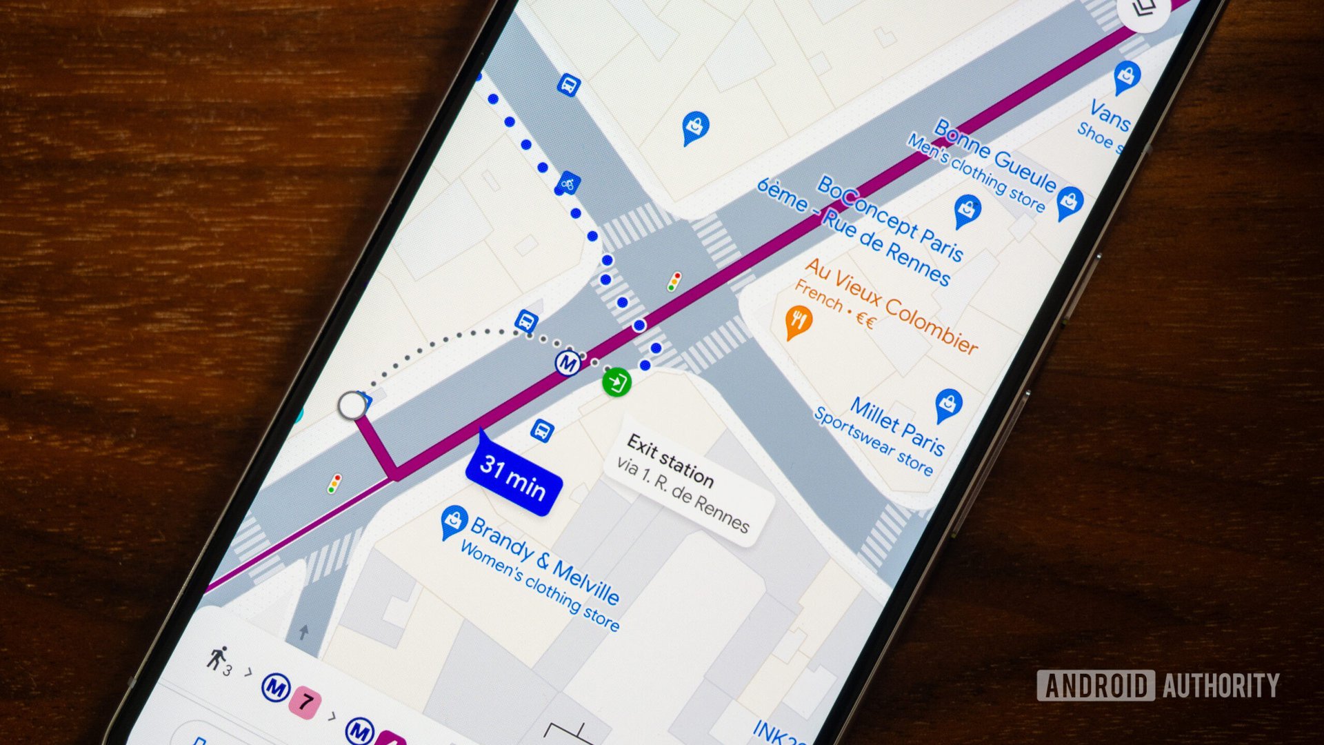
google maps transit directions

Credit: Rita El Khoury / Android Authority

  • Maps will soon provide public transit and walking suggestions next to driving routes if the travel times are comparable and practical.
  • Search is expanding a feature for finding information on long-distance train routes and adding support for buses.
  • Maps will also introduce a few features to help you find chargers for your EV.


Google is about to introduce a bevy of new features to Maps and Search. These new features are centered around making sustainable travel easier for everybody.

Today, Google announced some updates to Maps and Search will be coming soon. These features range from eco-friendly travel suggestions to electric vehicle (EV) charger placement and more.

One of the updates coming to Maps will help the user find alternative travel options that produce fewer carbon emissions. Said to be landing in the coming weeks, this feature will allow Maps to provide public transit and walking suggestions next to driving routes. This feature will be available in 15 cities including: Amsterdam, Barcelona, London, Montreal, Paris, Rome, and Sydney.

On a related note, Google says it is expanding a feature in Search that allows a user to see schedules, tickets, and links to complete bookings on the results page for long-distance train routes. This feature will now be available in 38 countries, such as Australia, Japan, Greece, and more. In addition, the firm is adding support for long-distance bus trips as well, which will be available in:

  • Brazil
  • Canada
  • Chile
  • France
  • Germany
  • Ireland
  • Italy
  • Japan
  • Mexico
  • Poland
  • Spain
  • Sweden
  • Ukraine
  • UK
  • US

As for flying, Google is making it easier to see the carbon emissions created by your flight. The company plans to make travel impact model (TIM) insights — which provide emission estimates — available as a developer API that can be applied on any website or app. This will also be available as a Google Sheets add-on and a calculator on the TIM website.

Moving on to EVs, Maps is getting some features that make it easier to find chargers. Google says in the coming months, the app will start showing AI-powered summaries that describe where a charger is located in an area, like a multi-level parking lot. On top of that, Google is adding the ability to see chargers on the in-car map, joined by information like real-time port availability and charging speed. This is expected to roll out globally in the coming months, starting with vehicles that have Google built-in.

The final two features deal with planning your trip with your EV. Last year, Google debuted a feature that shows drivers the best charging locations for EVs with Google built-in. The company is now expanding that feature for multi-stop trips. Along with this, google.com/travel will now display hotels that offer EV chargers.

If you’re trying to lower your carbon footprint, these features should come as a welcomed addition to Maps and Search.

Navigation in Google Maps just went (a little) 3D

Google Maps stock photo 6

Credit: Edgar Cervantes / Android Authority
  • Google has added another 3D buildings option to Google Maps.
  • The app already offered a 3D buildings toggle as a layer, but this option applies to navigation.

Google Maps is considered the top dog in the mapping space today, but Google is constantly adding new features and making tweaks to the app. And it looks like the latest addition is a neat visual tweak. 

Google Maps gets ‘glanceable directions while navigating’ for Android and iOS

Google Maps GPS Nagivation stock photo

Credit: Edgar Cervantes / Android Authority

  • Google is widely rolling out a glanceable directions feature for the Maps app.
  • The feature is available on Android and iOS.
  • You’ll need to turn the setting on first to start using it.


Google Maps is about to become a lot more useful on your lock screen. The app is getting a new setting called “Glanceable directions while navigating.”

Back in February 2023, Google announced the Maps app on both Android and iOS would get a glanceable directions feature. This feature would allow Android owners to see where to turn, as well as get live ETAs all from the lock screen. It also works on the route overview screen, even if you don’t hit Start. Meanwhile, Google Maps on iPhone would use iOS’s Live Activities for the feature.

The feature was supposed to launch globally back in June 2023, but may have only been available to a small group of users. But it looks like it’s now becoming available for everybody.

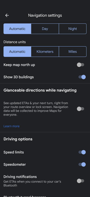
First spotted by Android Police, the feature appears to now be rolling out widely for users on version 11.116 for Android and 6.104.2 on iOS. I can also confirm that my own device now has a toggle for the setting that you can see below.

Glanceable directions

Credit: Ryan McNeal / Android Authority

The toggle is off by default, so you’ll have to enable the setting. This can be done by navigating to Settings and scrolling down Navigation settings. You should find Glanceable directions while navigating right under Map display.


❌